Best Foot Forward: Norland Moor


It’s so easy these days to drive a road many times and not think what you might see if you were to stop, get out and explore on foot. This I discovered when I decided to explore Norland Moor; it seems an unlikely place to have a moor, situated so close to Sowerby Bridge and Halifax itself, yet once up there, you could be miles from anywhere at all, such is the way with Yorkshire.
Beginning from a car park on Moor Bottom Lane, opposite the Moorcock Inn, [Grid Ref SE 055 218, HX6 3RP] climb up to the Moor to meet the Calderdale Way, a 50 mile, circular route devised in the 1970s that takes in Halifax, Hebden Bridge and Todmorden; is generally clearly way marked and maintained well by groups of dedicated volunteers, such as CROWS [Community Rights of Way Service]. This particular walk is just under seven miles long.
Advertisement
Hide AdAdvertisement
Hide AdNorland Moor itself has many different paths, so it is a great place for a short, post-Sunday lunch, walk off the Yorkshire puddings-type wander, or simply a place to let the dogs [and children!] stretch their legs. From the Moor you can see the Wainhouse Tower on the outskirts of Halifax; originally built in 1875 to be a mill chimney, however this intention was never realised, and was used during the Second World War as an observation post.

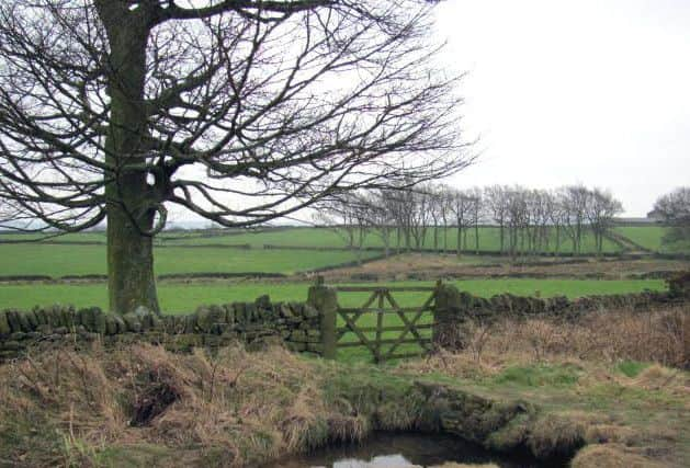
You can either follow the Calderdale Way, or keep to the path following the edge of the Moorland; either way you will meet Norland Road. Cross the road, turn left onto Turbury Lane and almost immediately you will re-join the Calderdale Way, entering onto Greetland Moor. The path follows a stone wall on your right, behind which is woodland. After approx. 0.5km, you have the opportunity to descend into the woodland using a path on your left,
alternatively you can keep following the Calderdale Way to avoid the climb back out again!
At Grid Ref SE 081 221, turn right and follow the road, heading towards Greetland. After a few hundred yards, there is a waymarked path on your right [with a track going off on your left]. Take the path and follow the edge of the field; these fields are farmland and at times there are wire fences; best to keep dogs on leads here. Keep going straight, keeping to the edges of the fields and you’ll return to meet Turbury Lane once again. The path continues straight ahead, you’ll pass through a small woodland area and emerge next to a sports ground. When you get to the road [Norland Road], turn left and walk on the road until it meets with the B6113 at the Spring Rock pub. Take the track on the right-hand side of the road, just behind the phone box, and follow that for a few hundred yards, until the path splits into three. Take the left-hand path and follow the path in a straight line, this time walking the other edge of Norland Moor. At this point you can, should you wish, return to the start; there are various path options to do so. If, however, you decide to continue, you will reach Butterworth End Lane – you will see caravans to your left and the beauty of the Calderdale landscape ahead of you. Turn left and walk on the road; you’ll see a track leading off to the right, it looks to be a driveway into private property, but it is clearly waymarked as a path, so you can’t go wrong! The track descends into the valley, eventually meeting the disused railway track at the very bottom. This is often extremely muddy, so gaiters come highly recommended, however you can keep to slightly higher [and less muddy] ground along the valley bottom. The railway follows the course of the River Ryburn and you can walk from here to Ripponden, which itself is a fantastic starting point for many a walk. The Ryburn Valley branch railway at its height carried passengers on 17 daily trains each way between Sowerby Bridge and Rishworth, but was closed to passengers in 1929, with freight trains continuing until 1958, with tracks being removed from the line in 1962.
Advertisement
Hide AdAdvertisement
Hide AdOn reaching the railway line, you must cross a stone bridge, and there turn right. It’s a pretty walk, especially when dappled sunlight filters through the trees. You’ll pass a campsite on your left and there are various opportunities to climb out of the valley, depending on how far you wish to walk. There is a footbridge at Grid Ref SE 049 225 where after a short but steep climb, you should find yourself on tarmac which eases the climb. Follow the road uphill and you’ll find yourself on Longley Lane, which in due course will return you to the starting point.
As said before, Norland Moor is a great place to walk, both short and longer distance. It is easily accessible on foot from a number of starting points; there is a lovely climb up from Sowerby Bridge train station, you can get there on foot from Ripponden [Mill Fold car park is free]. There are many interesting paths in and around Barkisland itself, where one can see Barkisland Hall, built in 1638 for John Gledhill, and where you hopefully will not find a local miscreant detained in the old stocks that still sit by the side of Stainland Road!