Best Foot Forward: Pikes and Cloughs


Stoodley Pike is a popular walking destination from Hebden Bridge and there are a myriad of circular walks one can take incorporating it. This walk is a great way to climb, albeit rather gently, up to Stoodley, and then returning across moorland with beautiful scenery.
The trickiest parts of this walk are the navigation out of Hebden Bridge itself and the return into it! I would recommend the use of the larger-scale OS Maps that are available to buy in the Tourist Info Centre itself.
Advertisement
Hide AdAdvertisement
Hide AdBeginning at the Tourist Info Centre, walk along the main road and turn into the park you will soon see. Here, join and then cross the canal when you can. You can follow a path that will lead you to cross the river and subsequently the railway line, emerging onto Palace House Road. You will see a way-marker immediately indicating a right which appears to be a private driveway into new houses, but take the second right-hand way-marker, following a track as it ascends into woodland. Here is where it can be confusing, indeed I was confused, but it’s always a bit tricky navigating in woodland where the trees block your view! That said, the paths are clear, and essentially, you need to be climbing up, therefore if you take a wrong turn, you should find your way. We ascended bearing south-east, turning right before taking another left turn; zig-zagging through the wood. We left behind the woodland on a path that went through a small tunnel at a cross roads before turning left again to meet a clearly defined path. You will follow this path in a continuous direction for a while, and soon enough you will enter Pinnacle Lane – once you get sight of Stoodley Pike you cannot really go wrong.
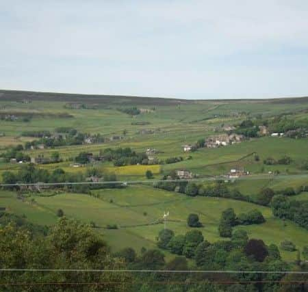
You will join the Pennine Bridleway and follow the way-markers; turning left and the right past Kershaw Farm and then you will pick up a way-marker for Stoodley Pike, using the Pennine Way [the Bridleway continues straight ahead, instead turn left off it]. The path to the Pike is very clear, and usually there are many other walkers and indeed, runners, using it. At the Pike, shelter for a coffee or lunch stop – it is always windy! The weather this time was much more favourable than the Easter-day walk when I was last here; the views are fantastic. I adore seeing the mixture of clearly defined farmlands and fields, as well as the moorland. At this time of year there is still some yellow of what I presume to be oil seed rape in the fields, but there are buttercups a-plenty, decorating the grasslands around.
From the Pike, continue to follow the Pennine Way along the ridge until you meet the cross-roads of paths; where you will turn left to follow the Calderdale Way. From here, follow the way markers and Withins Clough Reservoir will come into view. Descending to the edge of the reservoir, follow its edge until you reach the car park. Here, the Calderdale Way continues, descending to your right, but instead, take the tarmac road up to your left. Continue along the main track; on reaching Coiners Bank car park, go right, leaving the tarmac to join a stony track. At Crumber Hill, the track bends to the left, continue ahead, following the track. You will leave the track when adjacent to Coiners Barn; there is a distinct path, initially lain with stone slabs, continuing straight ahead – follow this. Here the land does become rather boggy and the path less distinct, but you should keep generally in the same direction.
Up ahead on your righthand side you will see Broadhead Clough Nature Reserve – a distinct dip in the terrain, full of trees and foliage. You are aiming to curve around the tip of the clough, bending slightly to your right. You will meet a way marker with various routes proposed. Continue ahead, bearing slightly north-east if you have a compass. There is a former boundary wall, now, much overgrown but with stones showing the boundary line. Follow this across Erringden Moor, continue straight ahead. You will pass a way-marker; on the map it says Broad Head, and if to turn right you’d descend to Mytholmroyd. Instead, continue ahead – again more boggy ground. You should descend to a track, where you bear right a short while before picking up a clear way-marker that will descend through the beautiful woodland adjacent to Moorside Barn.
Advertisement
Hide AdAdvertisement
Hide AdOn reaching the road, bear left and you will reach Wood Top. Here, turn right [Spencer Lane], then ahead you will see a way-marker beyond the house immediately ahead. Pass to the left of the house and bear left. This path take you through woodland above Hebden, with steep drops alongside. Here, if you know the area, you’ll know how to get back to where the route started, but we continued, until taking a small ginnel that lead us to a ‘proper’ road. We turned left, walked until we reached a traffic light and found we were back at the railway crossing we passed at the start.